Lake Sørvágsvatn
December 10, 2018 7 min read
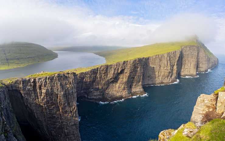
Try an image search with the keywords Faroe Islands and one of the top results will be a photo of Lake Sørvágsvatn. The panorama of the lake and the dramatic sea cliffs is a contender for the title as the most awesome sight in the Faroe Islands.
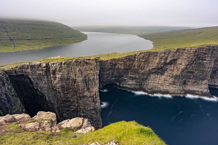
From the viewpoint at the Trælanípa sea cliff, the narrow lake appears to be perched high above the Atlantic Ocean. This is an optical illusion, the lake is only around 30m (98ft) above sea level.
Visiting this unique and beautiful place is a must when you come to the Faroe Islands. It takes a hike to reach Trælanípa, but it’s an easy one and I recommend doing it even if you are not usually keen on hiking.
If you’re considering a guided tour to explore the Lake Above the Ocean, see the Tours to Lake Sørvágsvatn section at the end of the post for recommendations.
The locals use two different names for the lake depending on where they live on the islands. Some call it Sørvágsvatn and others prefer Leitisvatn. The lake itself is on the island of Vágar and it’s the largest lake in the Faroe Islands.
The fjord-like lake is around 6km long, stretching from Vágar Airport in the north to Bøsdalafossur waterfall in the south. Bøsdalafossur is the outlet of the lake where the water flows into the Atlantic.
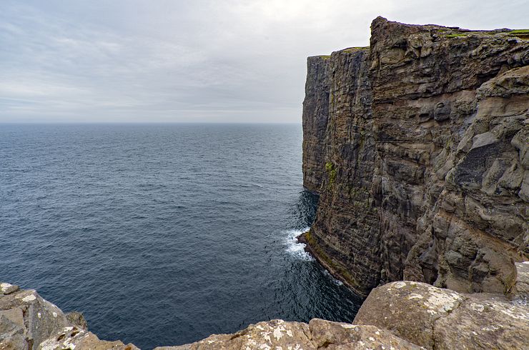
The best view of the lake and the sea cliffs is from Trælanípa. The Faroese word Trælanípa means slave cliff or slave rock. To trace the origin of the name, we must go back to the Viking Age. To punish disobedient slaves, the Vikings pushed them off the 142m (466ft) high cliff towards certain death in the ocean.
The hike to Trælanípa and Bøsdalafossur is about 3km one-way and it’s one of the easier hikes you are likely to do in the Faroe Islands. For most of the hike the path goes through flat terrain with only moderate changes in elevation. The path crosses a few rivulets, but they are easy to pass by stepping on stones.
It’s impossible to get lost, the trail runs parallel to the eastern shore of the lake. The hike takes around 45-60 minutes one-way and you walk the same way back.
A good pair of shoes is recommended as the path can get wet and muddy if it’s raining. This is the Faroe Islands and sudden shifts in the weather are common. Prepare for rain even if it’s sunny when you set out on the hike.
Starting April 2019, foreign visitors must pay a fee of DKK 200 for hiking to Trælanípa. According to reviews at Tripadvisor, the fee is collected at the parking at the start of the hike. Guided hikes are available for DKK 450.
We did the hike in early July on the day we arrived to the Faroe Islands. That’s in high season but it wasn’t exactly crowded around the lake, we only met a dozen or so of other tourists.
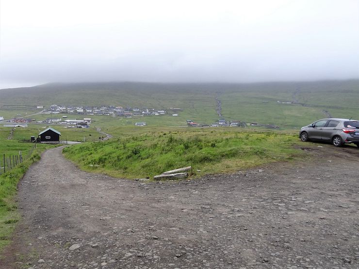
The trail starts in the outskirts of Miðvágur where there is a small parking. Two bumpy gravel roads lead to the parking and you can take any of them. If you don’t have a car, bus 300 from Tórshavn stops in Miðvágur on its way to the airport.
The trail to Trælanípa and Bøsdalafossur is marked on Google Maps. Move the map or open it in a larger window to see the whole path.
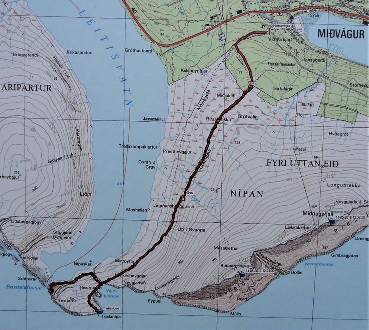
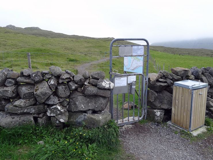
An information board at the trailhead has a map of the area and the hiking trail. There is a single trail for most of the hike, but in the end it forks into two paths, one to Trælanípa and one to Bøsdalafossur.
I’ve seen recommendations to start the hike from the main road (Road 11) and follow a path closer to the lake than the one we walked. There is a turnout from the road used for parking (coordinates 62.045206, -7.216357). We didn’t walk this path so I don’t know how it is, but I read one hike report saying the path was closed during the summer of 2018 to let the nature recover. It’s probably best to stick to the path described in this post.
When we did this hike in July 2018, there were no restrictions on hiking around the lake. Starting April 2019, foreign visitors must pay a fee of DKK 200 for hiking to Trælanípa. According to reviews at Tripadvisor, the fee is collected at the parking at the start of the hike.
This is yet another hike in the Faroe Islands you must pay for. I think that’s fair, with an increasing number of tourists, the landowners have higher maintenance costs so I understand they charge a fee. What I don’t like is when they require you to walk with a guide if it’s an easy hike. It’s still allowed to hike to Trælanípa and Bøsdalafossur on your own, but for those of you who want a guide, there is a tour available for DKK 450.
For booking a guided tour see tralanipan.fo or the Tours to Lake Sørvágsvatn section below for tours covering not only the hike, but also other top sights on Vágar.
Summer is naturally a good time to visit the lake, with the best chance of good weather and maybe even some warming sun. I would also like to see the lake in the autumn when the color of the grass has shifted from green to different shades of yellow and brown. During autumn and winter, the sea can be rough and the view from Trælanípa is dramatic with the waves hitting the sea cliffs. I would say the lake is great to visit all year around, with a different experience each season.
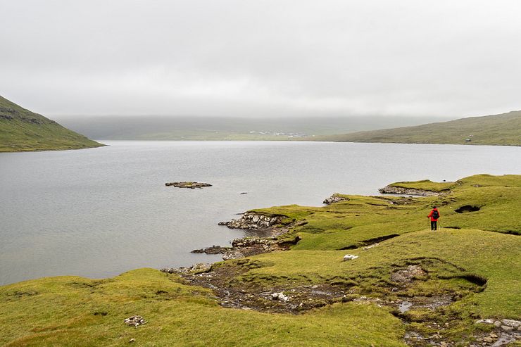
After driving the short, bumpy gravel road to the small parking at the trailhead, it’s time to start the walk to Trælanípa. It is cloudy when we start walking, but no rain yet.
An iron gate marks the start of the path and here is also the information board with a map of the area. A sign urges you to stay on the footpath to protect the wildlife.
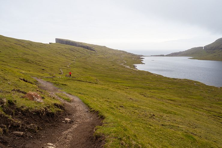
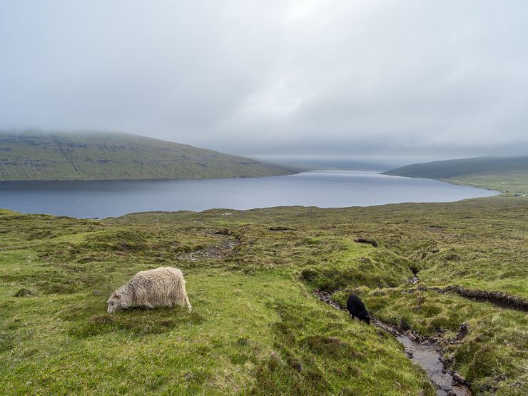
If the weather is decent, it’s easy walking. The scenery isn’t spectacular early on, but it’s a pleasant and peaceful walk. There are birds and sheep around of course, we are in the Faroe Islands after all.
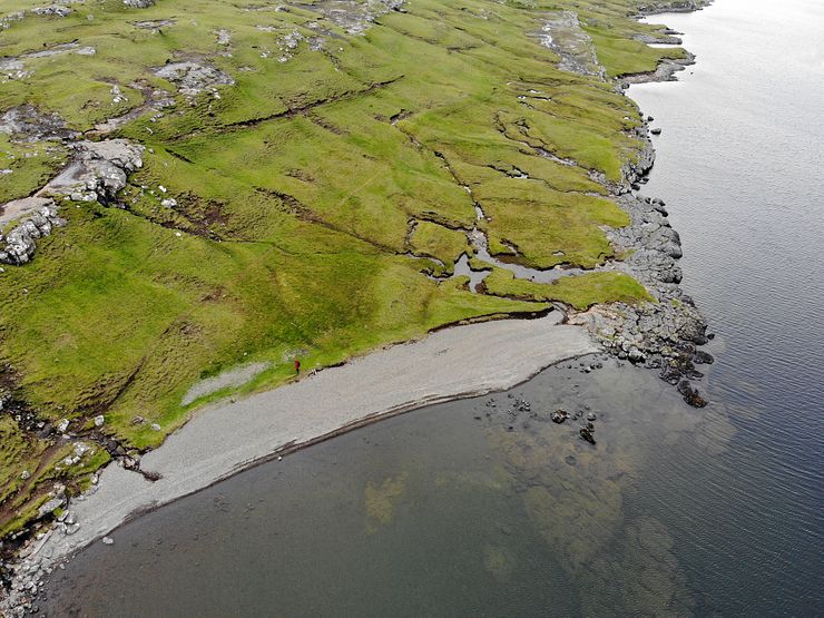
Bring your swimsuit if you happen to be at the lake on a sunny, warm day (yeah, right). There is a beach waiting for you!
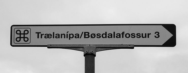
After a nice walk we are approaching the point where the trail forks and we have Trælanípa to the left and Bøsdalafossur to the right. Whatever you do, don’t miss walking up to the viewpoint at Trælanípa.
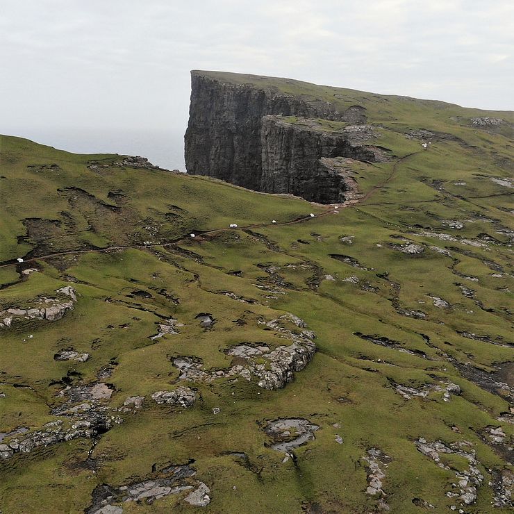
When we did the hike, they had marked the path with big white plastic bags making the already clear path even easier to follow. The photo below shows the section of the path just before the ascent to Trælanípa. There is no obvious path to the top of the cliff, just walk up the slope to arrive at the viewpoint.
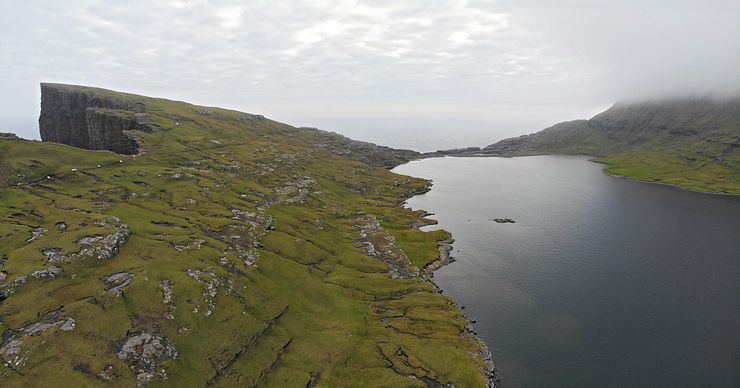
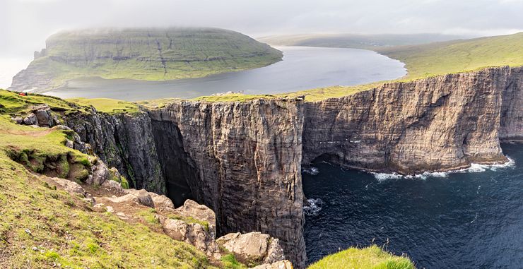
The view from Trælanípa is amazing. We got lucky, the sky suddenly cleared, and the sun lit up the lake and the cliffs for a while before disappearing again. We stayed here quite some time to take in the incredible scenery.
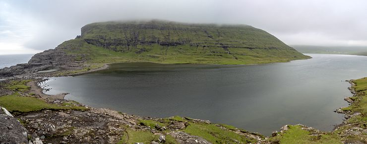
The lake looks more like a river as it bends around the mountain on the far side.
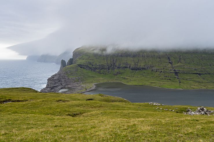
After Trælanípa, we went down to see Bøsdalafossur and the Geituskoradrangur sea stack which you can see the tip of in the photo below.
Due to a malfunctioning memory card, I lost some photos from the day at the lake, among them all captures of Bøsdalafossur. Here is a link to an image search of the waterfall.
It’s only a 10 minute drive from the airport to the start of the hike and you can plan this activity on the day of arrival if you have an early incoming flight. A couple of other sights on Vágar you can combine with Sørvágsvatn are the Múlafossur waterfall in Gásadalur and the Trøllkonufingur viewpoint close to Sandavágur.
From the scenic road between Bøur and Gasadalur you see the Drangarnir sea stacks and the Tindhólmur islet in a distance. To see Drangarnir close, you must do a hike. Another popular activity is to make a day trip to Mykines to see puffins and hike to a lighthouse. Both Drangarnir and Mykines are activities taking the better part of a day, but you can do one of them together with Sørvágsvatn if you are on a tight schedule and do it on a long summer day.
This section contains affiliate links. When you make a purchase of a tour through a link, I may earn a small commission at no extra cost to you. Thanks for your support — it helps keep the site afloat.
If you are considering a guided tour for your visit to Lake Sørvágsvatn, I recommend checking out Guide to Faroe Islands. They offer a wide selection of tours.
A tour of Lake Sørvágsvatn with the Trælanípa sea cliff and the Bøsdalafossur waterfall is usually part of a larger itinerary that includes several other locations. Many travelers opt for a half‑ or full‑day tour covering the main highlights on the island of Vágar.
Consider staying a night or two on Vágar, as there is plenty to do on the island. A typical tour includes the hike at Lake Sørvágsvatn to see Trælanípa and Bøsdalafossur, followed by views of the Drangarnir sea stacks across the fjord from Bøur. The day usually ends in Gásadalur with the picturesque Múlafossur waterfall.
There are several tours covering the top sights on Vágar. The Inspiring 6 Hour ‘Lake Above The Ocean’ Tour tour is especially convenient if you’re based outside Tórshavn, as it includes pickup across the Faroe Islands.
If you’re staying near Miðvágur on Vágar, the Classic 4 Hour Tour of Vágar Island might be a good option, as it doesn’t include transfer to the starting point. You simply meet the guide in Miðvágur, and all transport is provided from there. It’s best joined as a small group, since the price is quite steep for solo travelers.
If you’re based in Tórshavn, consider the Essential 6 Hour Highlights of Vágar Island tour. It includes hotel pickup in Tórshavn and all transfers between sights. The drive to Vágar follows the scenic Oyggjarvegur mountain road, with photo stops along the way.
A different take on the classic tour is Vágar Island – The Photography Tour, lead by a local photographer. You’ll visit the same sights as the other tours, but with a photographer’s perspective.
If you prefer exploring Vágar with a small group, check out the Wonderful 6 Hour Tour of Vágar Island with pickup and transfer from Tórshavn.
For travelers who prefer kayaking instead of hiking at Lake Sørvágsvatn, the Affordable 3 Hour Kayaking on Lake Above the Ocean may be worth considering. The basic version of this tour includes a three‑hour kayak rental, but the duration can be extended, and it can also be done with a guide.
Comments
Comments are closed. Contact me if you have a question concerning the content of this page.