Drangarnir hike
July 20, 2018 10 min read
The Faroe Islands have a handful of stunning places often featured on Instagram and in travel blogs. Most travelers visit the Múlafossur waterfall in Gásadalur, the Sørvágsvatn lake, the Kallur lighthouse on Kalsoy and the island of Mykines known for its large colony of puffin birds.
Fewer visitors find their way to the spectacular Drangarnir sea stacks just off the western shore of the island Vágar. You can see Drangarnir from the scenic road between Bøur and Gásadalur, but to come close you have to make a hike or join a boat tour.
Since I first hiked to Drangarnir and wrote this post, a new way to see the sea stacks has become available. A boat tour now takes you to the viewpoint in just 10 minutes, and you’ll have about 1.5 hours on land to enjoy the views and take photos. This means you can skip the hike from Sørvágur, which can be strenuous for inexperienced hikers. The entire tour takes around 2 hours, leaving plenty of time to explore other sights on Vágar the same day.
For more information about the tour, see Official 2 Hour Boat Tour & Hiking to Drangarnir Sea Arch (affiliate link) provided by Guide to Faroe Islands. They offer a wide selection of tours to destinations all over the Faroe Islands.
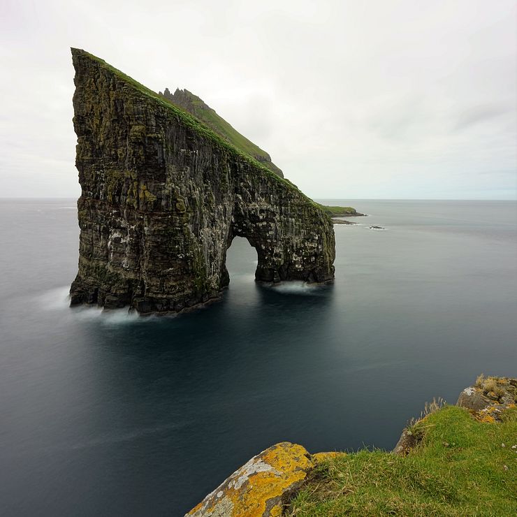
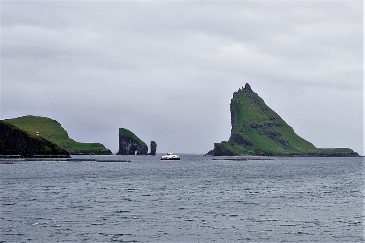
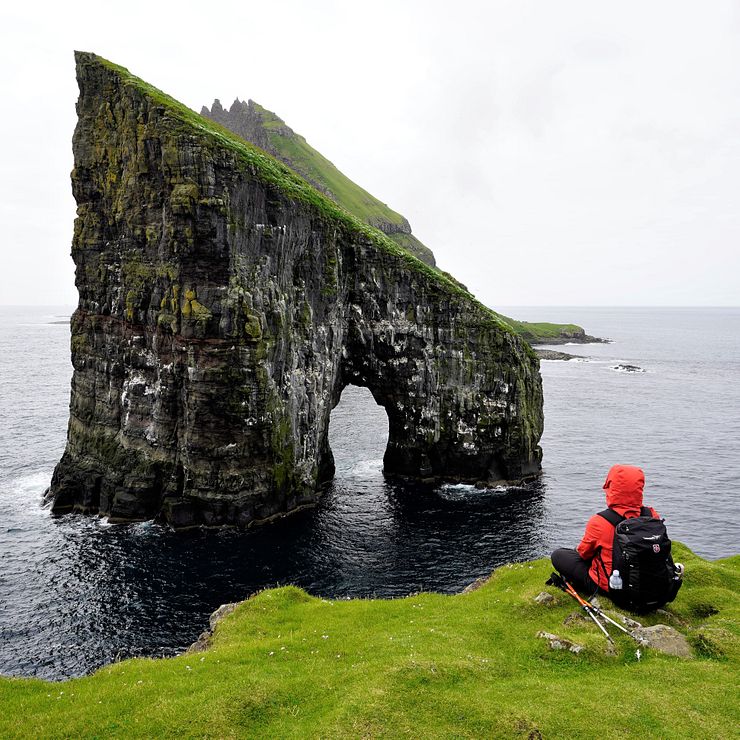
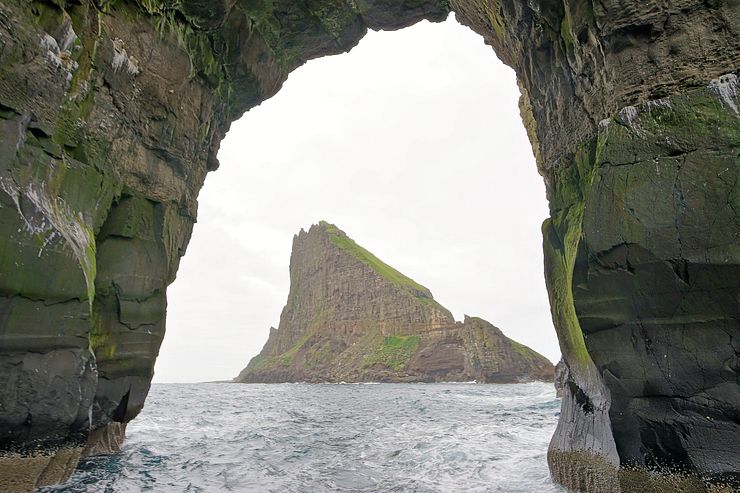
Drangarnir is the name of two sea stacks between the island Vágar and the striking islet Tindhólmur. The name of the largest stack is Stóri Drangur and the smaller one is Lítli Drangur. As you might expect, this is Faroese for large and small sea stack. Stóri Drangur with the shape of an open arch is the one known from all photos of Drangarnir.
Drangarnir, together with Tindhólmur, is one of the top sights in Faroe Islands and I highly recommend doing the hike to the sea stacks.
A geological landform consisting of a steep and often vertical column of rock in the sea near a coast, formed by wave erosion. (Wikipedia)
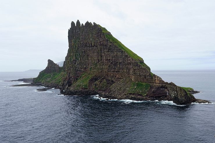
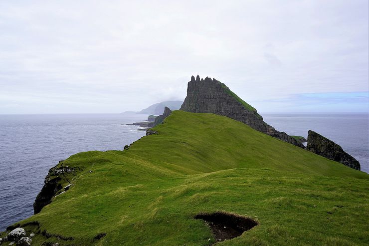
Tindhólmur is one of my personal favorites among all the awesome nature sights in the Faroes. Tind is the Faroese word for top, peak or spike and hólmur means islet. Tindhólmur translates to something like the islet of peaks, which makes sense considering its dramatic shape with five pointy spikes. When I see the islet, I think of a Stegosaurus dinosaur. It looks like Tindhólmur with the broad, upright plates on its back.
The names of the five peaks are Ytsti (Farthest), Arni (Eagle), Lítli (Small), Breiði (Broad) and Bogdi (Bent). The islet is uninhabited and its highest point is 262m (860ft). Where there is grass in Faroe Islands, there are sheep, but Tindhólmur seems to be the exception proving the rule.
Before the 2018 season, you could do the hike to Drangarnir on your own and there are several blog posts describing how to do it. This has now changed, you must join a tour and do the hike with a local guide.
We booked the tour the day before as we wanted to check the weather forecast before deciding on doing the hike or not. I don’t think the tour fills up so it should be ok to book late.
It is always difficult to say how hard a hike is as it depends on the weather on the day of the hike, your fitness level and hiking experience.
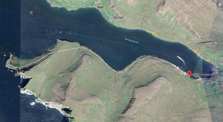
Despite the Difficult rating, you don’t have to be super fit to do this hike. If you are comfortable walking 10–12km on a combination of paths, sheep trails and grass in terrain with moderate changes in elevation, I would not call this a difficult hike unless you have a problem with heights. The final part of the trail traverses a sloping hill side and some passages might feel steep if you have a fear of heights. It is not like walking next to a precipice, but it is definitely not flat either.
Hiking to Drangarnir is tougher than other popular hikes on the islands, but again, it depends on the weather and your preferences. The hike to Sørvágsvatn is much easier as it is a good path and shorter distance.
We did a part of the Mykines lighthouse hike in mist and light rain and turned back after crossing the bridge as we couldn’t see anything. It was muddy and slippery on the steepest parts of the trail, but we anyway felt that hike was easier compared to Drangarnir.
I did the hike to the Kallur lighthouse on Kalsoy in a heavy mist with bad sight and soaked shoes. That hike is short and also easier than Drangarnir.
As the requirement on doing the hike with a guide is new and not widely known at the time of writing this post (July 2018), people are still doing the hike on their own. Some travelers know about the new rules and ignore them. Before heading out without a guide, consider that the land through which you hike is private property. According to Faroese legislation you need the landowner’s permission to walk in the area. Regardless of whether you think this is right or wrong, you should respect the law and do the hike with a guide.
If the landowners discover you while doing the hike without permission, they will charge you an amount at least equal to the fee of the tour.
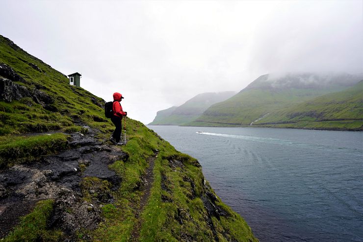
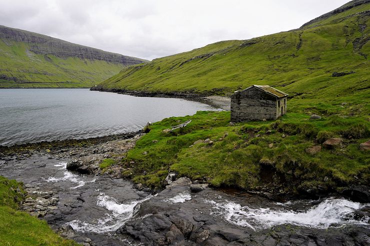
The good thing with doing the hike with a guide is that you don’t need to bother about finding the best route and you get information about landmarks on the way. The first part of the hike follows the fjord. We cross a few streams by walking on stones and pass several sheep shelters.
The Faroese weather with heavy rains and wet snow in the winter can be too much to bear even for the hardy sheep. When the weather gets too tough, the sheep seek protection in one of the shelters.
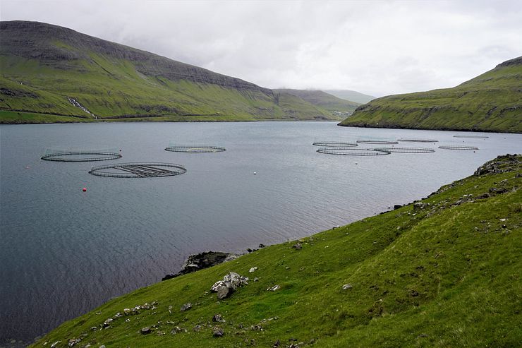
Fish farms are common in Faroe Islands, there is one in almost every fjord or bay with suitable conditions. This one contains salmon, but there are also farms producing rainbow trout.
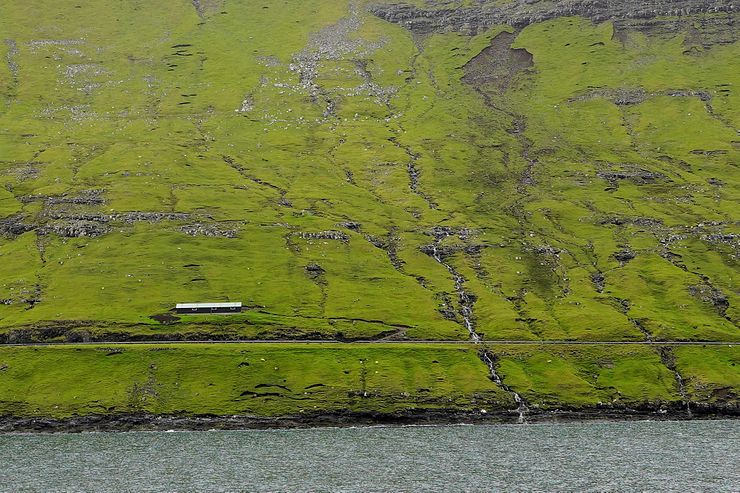
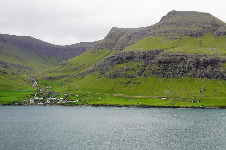
After about 3km, we pass the village Bøur on the other side of Sørvágsfjørður. A scenic road runs from Bøur to Gásadalur, the village with the pretty Múlafossur waterfall. From this road you also have nice views of Drangarnir and Tindhólmur across the fjord.
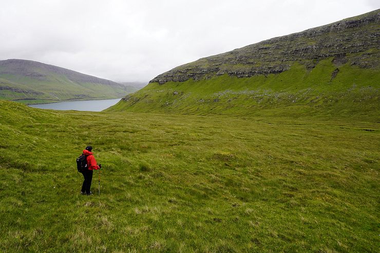
We cross a stream and then it is time to leave the fjord as the route goes inland through a beautiful green valley. We must walk with careful steps here, we see several birds brooding their eggs in nests on the ground. The birds can be difficult to discover and we don’t want to disturb them.
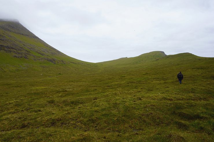
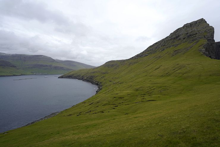
There is no path to follow in the valley, it’s just walking on grass. We are walking towards the hilltop to the right in the photo below. This is the only part of the hike where there is any substantial increase in elevation, but it is a gentle slope and an easy ascent.
When reaching the crest of the hill we are rewarded with a fabulous panorama over Drangarnir, Tindhólmur and Mykines in the background. You will have ample time here to admire the view and to mount a tripod for taking photos. This view is one of my favorites from the Faroe Islands.
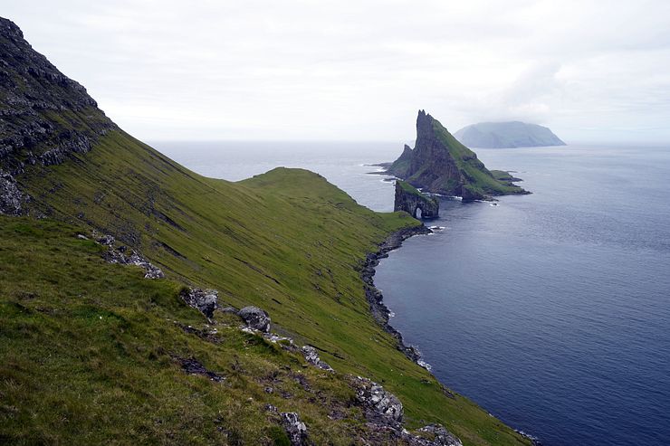
After the break it’s time for the final part of the hike. We traverse a sloping hill on narrow sheep trails working our way towards Drangarnir. This part can feel uncomfortable for people with a fear of heights as the traverse is made high on the hill side. It feels steeper in real compared to how it looks on the photo.
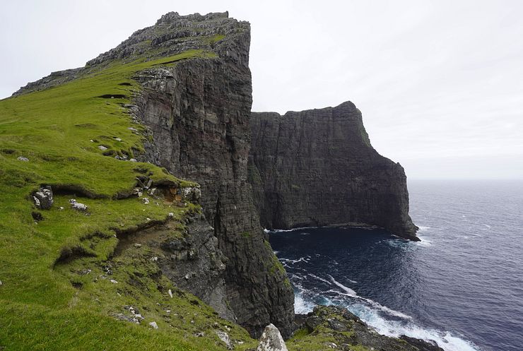
Before going to the viewpoint closest to Drangarnir, we check out an impressing sea cliff to the south.
It is pure joy to walk the last stretch to the Drangarnir viewpoint on the green and soft grass field.
Finally at the goal of the hike, Drangarnir! It is peaceful to sit down here a while just looking at the stunning view and observing the sea birds flying around the sea stacks.
We wanted to go down to the stony “beach” to take photos from the angle where Drangarnir and Tindhólmur line up nicely. The water level was too high on this day so we couldn’t do it.
It is time to return to Sørvágur after a terrific hike with amazing views. Using the boat service is perfect to save time and energy not having to walk back. As a bonus, you also get to see the sea stacks close from the water and even pass through the arch of Stóri Drangur. A perfect end of the tour.
We get a last close look at Drangarnir and Tindhólmur from the boat. The boat ride back to Sørvágur is quick and the whole tour lasted about 4.5h.

Comments
Comments are closed. Contact me if you have a question concerning the content of this page.