Klakkur
January 12, 2020 6 min read
One thing I like about the Faroe Islands is that it is relatively easy to access most of the sights. You don’t have to wake up at 3am in the morning for a tiring drive on rough gravel roads followed by hours of hiking to reach a viewpoint. The Faroese landscape is both small-scale and dramatic at the same time.
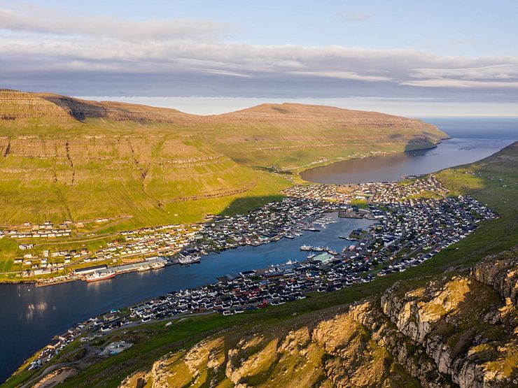
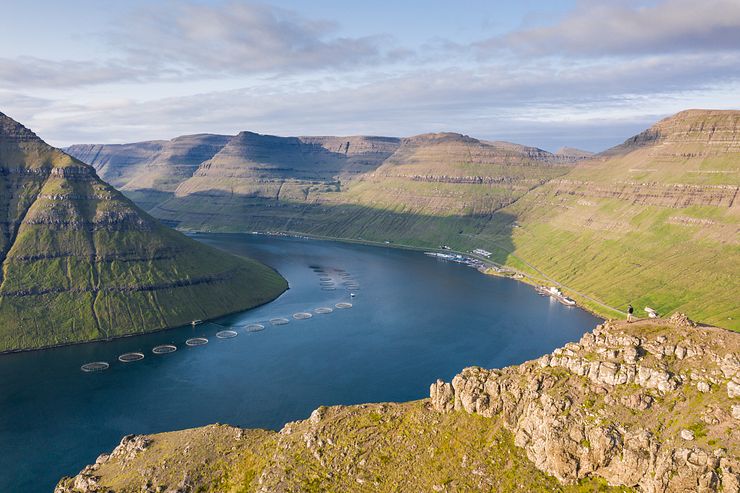
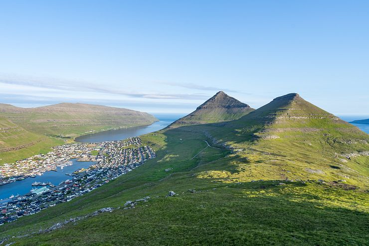
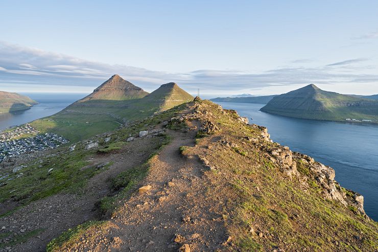
Klakkur is a small mountain (413m, 1355ft) near the town of Klaksvík. The hike to the top of Klakkur is low effort and high reward. From the top, you have an excellent view of Klaksvík and the islands of Kunoy and Kalsoy.
I recommend doing the Klakkur hike on the same day as the half-day trip to the Kallur lighthouse on Kalsoy. Klaksvík is the starting point for both activities.
It’s easy to hike to Klakkur on your own, but if you would prefer going with a guide, check the Tours to Klakkur section at the end of this post for recommendations.
Klaksvík on the island of Borðoy is the second largest town in the Faroe Islands with a population of 5.200. Fishing is the biggest industry in Klaksvík, the port is home to a modern fleet of fishing vessels. A road tunnel connects Borðoy with Eysturoy so you can either drive or take the bus to Klaksvík.
It’s a 40km drive (45m) on a good road from Tórshavn to Klaksvík. It used to take over one hour, but Eysturoyartunnilin, the new undersea tunnel completed in 2020, shortens the drive considerably. Driving from the airport takes about 1h15m.
There are bus connections to Klaksvík from several towns, for example bus 400 (1h30m) or the express bus 401 (1h5m) from Tórshavn.
The hike to Klakkur starts at Hálsur, a viewpoint located between the peaks of Klakkur and Hálgafelli. If Hálsur doesn’t up show up when searching in your map application, use the coordinates 62.22648, -6.60912 to find the location.
Driving from Klaksvík to the parking at Hálsur takes 10 minutes. If you don’t have a car, walking to Hálsur from the bus terminal (Bygdaleiðir) in Klaksvík is about 3.5km (2.2 miles).
My GPS navigator directed me to a dead-end street in Klaksvík. When driving you have to take Nýggivegur instead of Uppsalagøta before turning right onto Oman Eið.
An unpaved road nicknamed Ástarbreytin (The love path) runs along the mountain side from the outskirts of Klaksvík up to Hálsur. The dirt road is bumpy in places, but it’s ok to drive even with a small car. Continue on the road until you cannot go any further and you have arrived at the parking.
In 1938, the four villages Vágur, Myrkjanoyri, Gerðar and Uppsalir merged to form the town of Klaksvík.
From Hálsur, it’s a 30-45 minutes hike to the top of Klakkur. If it isn’t cloudy, you can see the peak from the parking. I guesstimate that the height difference between Hálsur and the peak is about 170m (558ft).
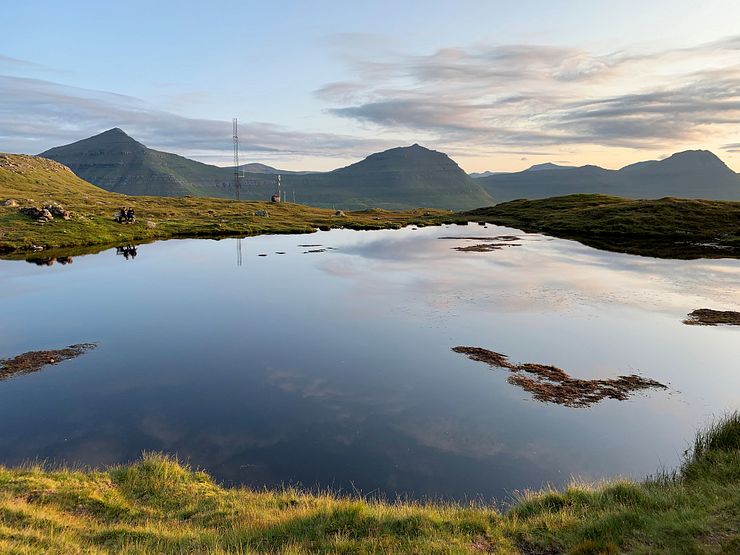
The dirt road continues 100m beyond the parking and you walk through a gate early on. At the end of the dirt road is a small pond where you turn right to continue in the direction towards Klakkur.
It’s uphill all the way from the pond to the top of Klakkur. Following the path is easy and you walk on grass most of the time. Klaksvík is down in the valley to the right.
I did the hike in 30 minutes including a few quick photo stops. It’s uphill, but it’s not steep and I would grade this hike as easy. Going back down to the car took only 20 minutes.
The top of Klakkur is a narrow plateau which you enter at the south end and follow to the north end where the best view is. The 360-degree view from Klakkur includes several islands, mountains and towns.
To the east is Klaksvík at the foothills of the mountains Myrkjanoyrafjall and Kjølin. Kjølin is the Faroese word for keel, the mountain looks like a boat turned upside down.
Looking back in the direction you came from, you see the southern part of Borðoy with the Hálgafelli (502m, 1647ft) and Háfjall (648m, 2126ft) mountains. To the south and southwest is Eysturoy and the town of Leirvík which you pass through before driving the road tunnel between Eysturoy and Borðoy.
Further south is the island of Nólsoy, but it’s only visible in clear weather.
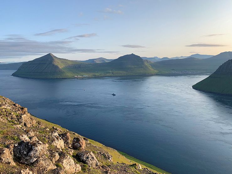
To the northwest is the island of Kalsoy. It lives up to its nickname, The flute, with its long narrow shape and eight road tunnel openings in the mountains looking like flute finger holes. The southernmost village on Kalsoy is Syðradalur. A ferry line connects Klaksvík and Syðradalur.
The island of Kunoy is straight to the north of Klakkur. Kunoy has six of the ten highest mountains in the Faroe Islands, all of them with heights exceeding 800m (2625ft).
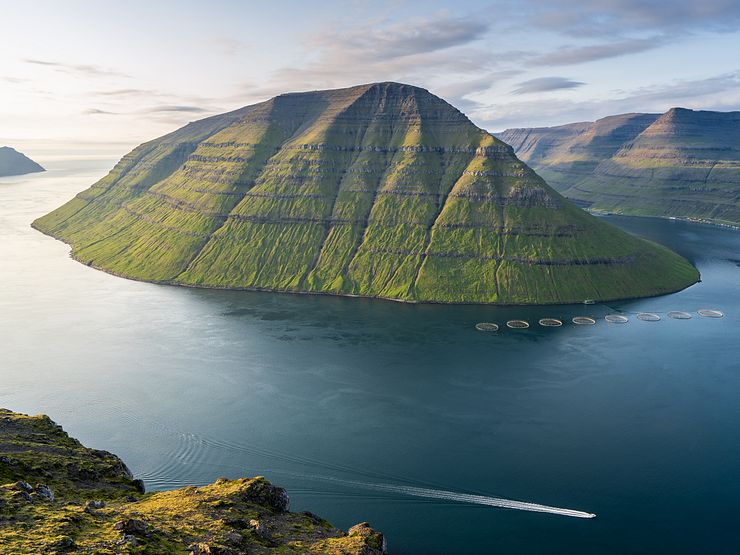
The mountain at the southern end of Kunoy, Suður á Nakki, isn’t the highest peak on the island, but I think it’s the most striking one. It has a round, smooth shape with grassy sides sloping down into the sea.
I was lucky to visit Klakkur on a beautiful summer day and several locals joined me to see the sunset from the peak. Such a perfect end of my day on Kalsoy and Borðoy before driving back to the hotel in Tórshavn.
The Kallur lighthouse on Kalsoy is one of the top sights in the Faroe Islands. You must take a ferry to Kalsoy so visiting Kallur is a half-day trip.
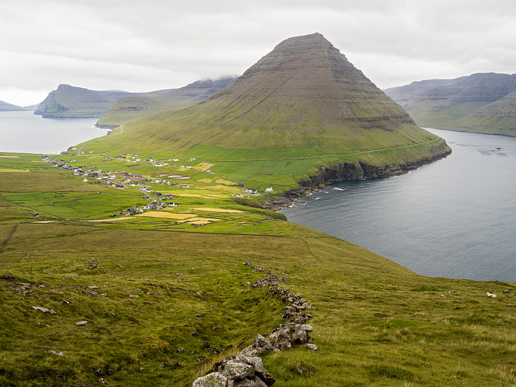
Viðareiði on the island of Viðoy is the northernmost village in the Faroe Islands. The village is 19km north of Klaksvík, a 25 minute drive. Hike up Villingadalsfjall for a great view of Viðareiði and the cone-shaped Malinsfjall mountain. If you are a strong hiker, you can continue all the way to Cape Enniberg (754m, 2474ft), the second-highest sea cliff in Europe.
It’s not necessary to hike to the top of Villingadalsfjall to get a nice view. It was cloudy when I visited and I turned around before reaching the top. Walking 45-60 minutes (very individual of course) on the path from the village should be enough to reach a good viewpoint.
This section contains affiliate links. When you make a purchase of a tour through a link, I may earn a small commission at no extra cost to you. Thanks for your support — it helps keep the site afloat.
If you prefer joining a guided tour instead of arranging the hike to Klakkur on your own, I recommend checking out Guide to Faroe Islands. They offer a wide selection of tours to destinations all over the Faroe Islands.
Consider the Peaceful 2.5 Hour Sunset Hike to Klakkur Mountain Ridge tour if you want to watch the sun set from the top of Klakkur — it can be spectacular. The hike starts in Klaksvík and is timed so you reach the summit right as the sun goes down. You’ll walk up from town, so expect a steady ascent to the top. Note that transport to Klaksvík is not included in the price.
Another option is the Northern Islands - The Photography Tour, which begins with a hike to the top of Klakkur before continuing north to the picturesque village of Viðareiði.


Comments
Comments are closed. Contact me if you have a question concerning the content of this page.