Lake Skadar
April 15, 2018 6 min read
Lake Skadar national park is located about 30 kilometers south of Podgorica, the capital of Montenegro. The dolphin-shaped lake has two-thirds in Montenegro and one-third in Albania. The beautiful lake is a popular destination and a road trip in Montenegro should include a stop here. A visit to the national park is also possible as a day trip from Podgorica, Budva or Kotor if you happen to be based in any of those places. Virpazar is a good starting point for exploring the national park.
Before arriving in Virpazar I had read travel reports warning about pushy touts selling lake cruises. When I rolled into the village with the car, a “parking attendant” dressed in a yellow vest stopped me. Instead of charging me for the parking she tried to sell me a lake cruise. That set the tone for my visit to Virpazar. I know that these people have to make a living, but they are annoying.
There is a visitor center in the village where you can get information about activities in the area. Most visitors come here for a lake cruise. There are all kinds of cruises on offer, ranging from one hour to a full day on the lake. The longer cruises cover a larger part of the lake and make one or more stops, for example at a fisherman’s village or at a monastery, there are several on the islands. If you hire a private boat, you can tailor the cruise to get what you like.
The park is good for birdwatching with over 280 different species of birds. You can see the world’s largest freshwater bird here, the Dalmatian Pelican, which is the symbol of the lake. If you like fishing, there are options on the tour menu for that too.
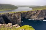
According to the nice staff at the center, you get the best views of the lake from the southern shore. There are viewpoints along the road leading from Virpazar towards the Albanian border. If you want to take a swim without joining a cruise, there is a pebble beach accessible by car in Murići.
Ask around to see if you find something interesting. I felt a cruise was not the right thing for me so I opted out. I cannot give recommendations on certain cruises or operators but from what I was told it is better to try one of the smaller boats instead of a bigger one.
Unfortunately, I did not have that much time to spend around the lake. I arrived later than planned due to horrible traffic along the coast the day before. Unless you visit Montenegro offseason, the narrow roads can be congested. I spent hours in traffic jams and I had a too tight schedule on this road trip.
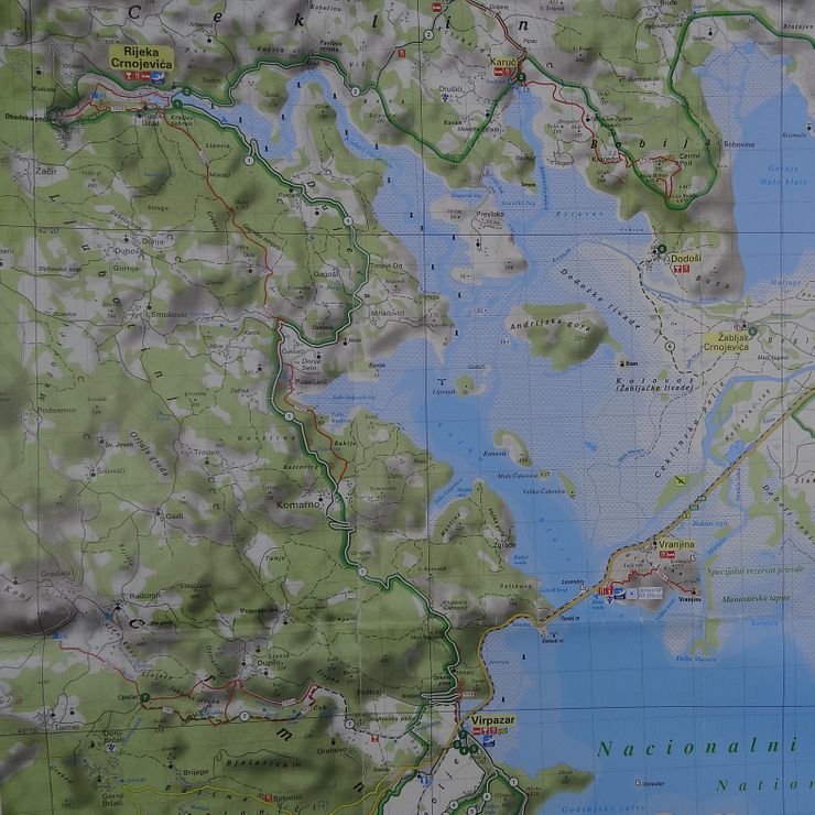
I bought a map at the visitor center. I love maps; it is great to sit down in front of a big map and plan where to go next. I use online maps and a GPS on road trips but nothing beats the feel of a real map.
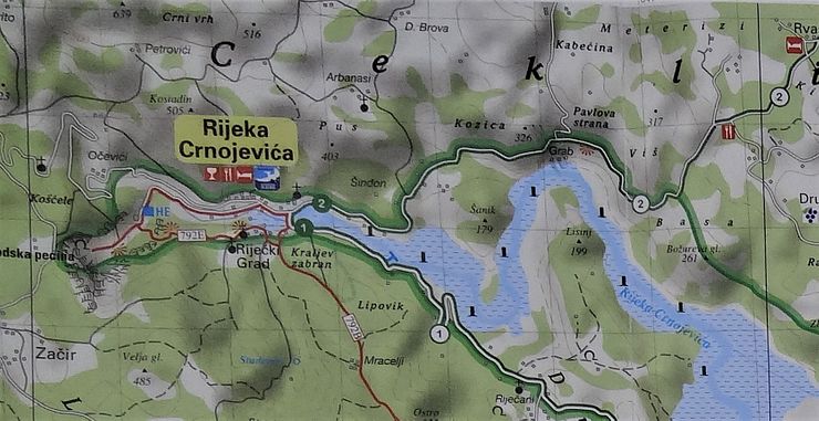
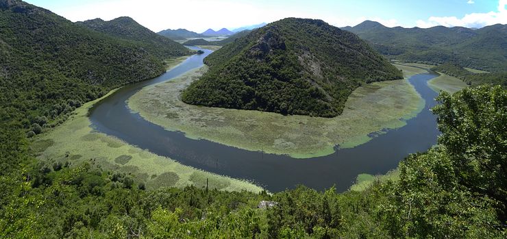
The national park has impressing panoramas and the best way to enjoy them is to get up to a higher altitude. I had my eyes set on a specific spot where a river makes a horseshoe bend flowing around a green hill. I had seen it on photos and located the place on my map, the Pavlova Strana viewpoint. The northwestern end of Lake Skadar turns into Rijeka Crnojevića, a river passing through a village with the same name. The viewpoint is just a few kilometers east of the village.
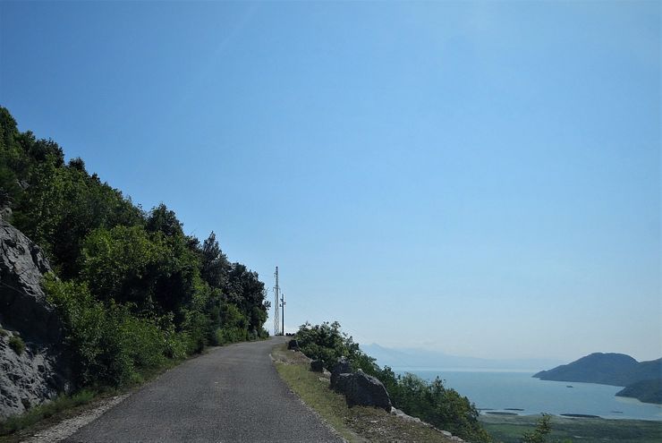
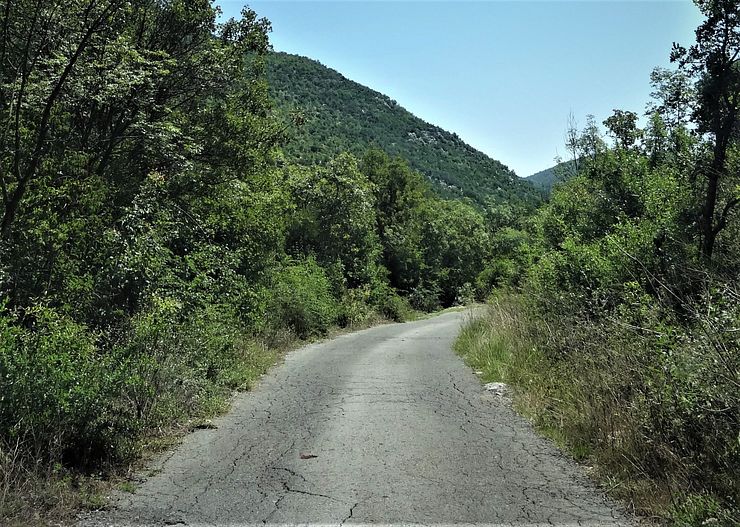
The drive from Virpazar to Rijeka Crnojevića is nice and you get some good views of the lake. The road is narrow but overall it is easy driving. It is better than some of the smaller single-track mountain roads in the region. On these roads, pullouts or wider stretches of road where cars can pass one another are scarce. Sometimes you drive next to a precipice and there are no protecting guard rails. I am no professional driver but I have done my share of mountain road driving and I did not feel comfortable on the worst of the smaller roads.
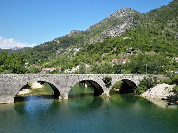
Rijeka Crnojevića is home to a few hundred people. Things were different back in the 15th century when the ruler of Montenegro, Ivan Crnojević, lost the capital Žabljak Crnojevića to the invading Ottomans. Ivan had no choice but to move his seat to the fortified hill Obod that rises behind the village. The king renamed the village to Rijeka Crnojevića and it became the new capital of Montenegro.
The village is a good place to stop for something to eat before continuing to the nearby Pavlova Strana viewpoint. If you want to take a boat ride on the river or go kayaking, you can arrange it in the village.
If you continue straight to the viewpoint without stopping in the village, cross the river and turn right in the 3-way junction. Follow the road up in the mountains. The viewpoint is not signposted so drive slowly while paying attention to the view and you will know when you are at the spot. You get stunning views from several places along the road and there are two options for parking. The first one is just a pullout from the road and it has room for a few cars. At this spot, you are closest to the river and it is easy to just step out of the car, take in the view and snap some photos.
Unless you have a camera with a wide-angle lens, you will have to make a panorama to fit the whole scene. At this spot there can also be vegetation obscuring part of the river. The view is gorgeous though, and the photos turned out alright.
If you are serious about your travel photos, you should check out spots further up the road. There is another place to park below an old hotel on the hillside close to the first spot. This “parking” is bigger and it is possible to turn the car around should you want to go back to the village. There is a viewing platform here which is convenient, but it is not the best spot for photos. Instead, walk a few hundred meters up the road and find a place with a different angle and a clear view of the river. You are exposed to the traffic here so be careful while taking the photos.
Behind the old hotel is a small curvy road crossing over the mountain to connect with M2.3. If you are driving to Rijeka Crnojevića from Kotor or Budva, it will be the shortest route to take the small mountain road. I did not drive it myself as I started from Virpazar but I talked to a guy coming that way. He said that the road is very narrow and in quite bad shape so you might want to consider continuing another 5 kilometers before turning right off the M2.3 (see the marker named M2.3 intersection on the map).
If you continue on to Podgorica from Pavlova Strana navigating with your GPS, you might end up on another narrow and poorly maintained mountain road. The easiest route is to continue on the same road until reaching the intersection with the bigger M2.3 road which will take you to Podgorica. I tried the smaller roads around the lake hoping to get a last good look at the national park before leaving.
I had been driving a single-track road for a while when the GPS suddenly decided it was time to turn around and go back! It was impossible to turn the car around so I moved on until I arrived at a lonely house. I stopped and asked for directions to Podgorica, the guy living there must have thought I was stupid coming this way. There was a language barrier, but it was obvious he advised me to go back the same way I came from.
I turned back and cursed myself for getting lost again; I do it all the time. It did not take long before another car driving in the opposite direction appeared on the road. No way we could pass each other, and no passing places close by. Isn’t that just perfect? As a visitor in the area, I felt it was my obligation to solve the deadlock. I reversed on the narrow road all the way back to the house I stopped at earlier. If you are on a tight schedule, stick to the bigger roads!


Comments
Comments are closed. Contact me if you have a question concerning the content of this page.