Caminito del Rey
June 17, 2018 15 min read
A popular and highly recommended road trip in Europe is to tour the Andalusia region in southern Spain. Andalusia is famous for sights such as Alhambra, the Seville Cathedral and Mezquita, the Mosque-Cathedral of Córdoba. These are in the itineraries of most trips, and they should be, but this post is about a lesser-known attraction near Ardales in the province of Málaga.
El Caminito del Rey, once called the world’s most dangerous walkway, is a spectacular man-made path built on the vertical mountain walls of three gorges along the Guadalhorce river. The walkway got a lot of publicity around the millennium when several hikers suffered fatal accidents on the path which was in a terrible condition. El Caminito was closed and it should take 15 years until it opened again. The new path, inaugurated in 2015, is completely safe and now everyone can enjoy the beauty of the area without risking their lives.
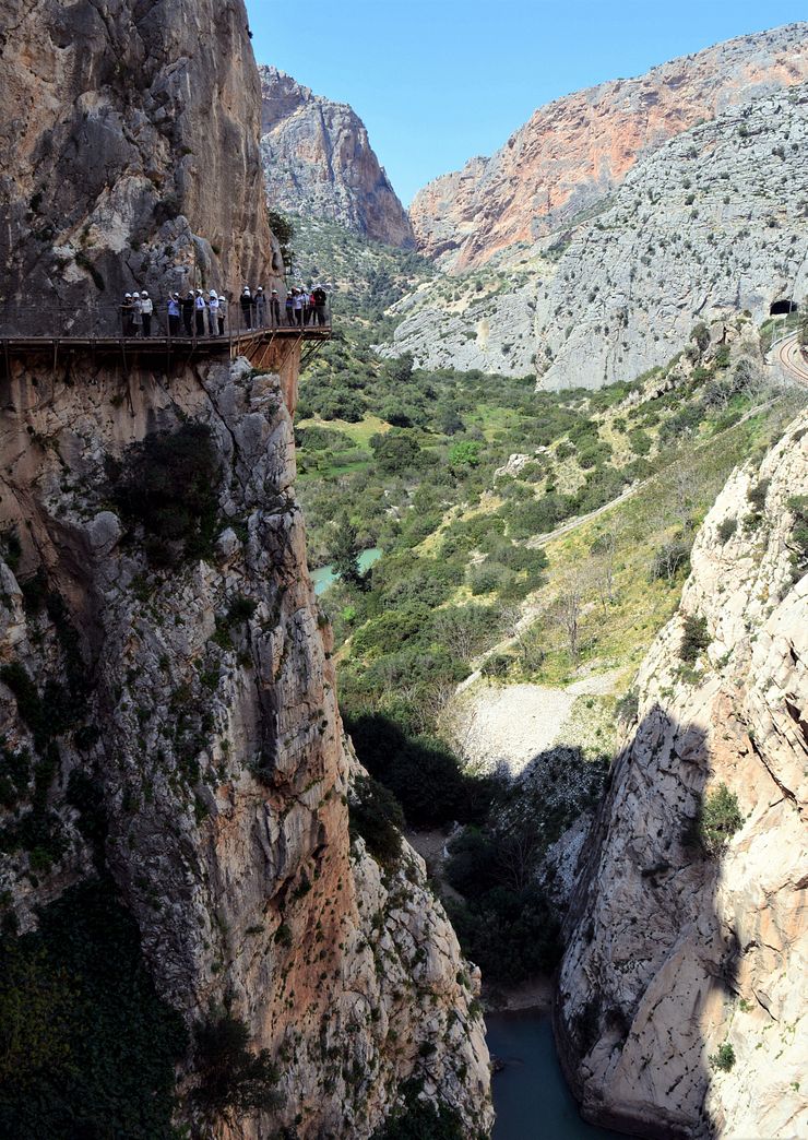 El Caminito del Rey.
Some years ago a friend asked me if I had walked El Caminito del Rey. When I said no, he showed me this video. After watching it with feelings ranging from excitement to fear, I knew I had to do this “walk”. I was into climbing, and with the use of some gear, the path seemed scary but doable. I never got around to visit Andalusia before they replaced the original path with the new one, other parts of the world were calling my attention. The new path is not the same adrenaline rush as the old one, but it is still a great walk!
The original path, completed in 1905, connected two hydroelectric sites in the area, the Guadalhorce reservoir and El Chorro Dam. The construction workers used the path for transport between the sites and for maintenance of a canal running in tunnels through the mountain from the reservoir to El Chorro power plant.
King Alfonso XIII of Spain opened the path in 1921 and he also walked (some say he was riding a horse) at least a part of the path. This event gave the path its name, El Caminito del Rey which means The King’s Little Pathway.
Caminito del Rey became part of the everyday life of the people living in the villages around El Chorro. It provided easy transport between the villages and children used it to go to school. The original path made of steel and concrete was about one meter wide and some sections were as high as 100 meters above the river at the bottom of the canyon.
El Caminito was not regularly maintained and with time it fell into disrepair. Large holes appeared in the concrete and the steel construction rusted. At some parts of the walkway, whole sections of the concrete layer collapsed leaving only narrow rusty steel beams keeping the path together. The bad condition of the path never stopped people from walking it and there were many accidents during the years. The path officially closed in the 1980s but as it was still accessible, people continued to walk it.
In 1999 and 2000, five persons died while attempting Caminito del Rey. The authorities tried to restrict access to the path by removing sections of it and also by the threats of high fines for walking the path. Not even this stopped people from all over the world to come to Andalusia to walk the Caminito. Local mountaineers put up a wire along the path that hikers could clip into for safety. The serious accidents continued until the path was sealed off and closed when a project to build a new path started in 2014.
Years of discussions and planning preceded the decision to restore the walkway. The proposal that got approved, financed and realized was to build a new lightweight wooden path above the old one.
I think it was a good decision instead of just replacing the old concrete path. The history of the Caminito is such an important part of the experience of doing the walk. Seeing sections of the old path and knowing the importance it had to the local people and also its tragic history, turns the walk into something more than just a spectacular path with great views.
Walking the Caminito requires some planning, if you just turn up at the start of the trail, you might get disappointed. During high season it is necessary to book a ticket for the path well in advance. There is also some logistics you need to know about. Most of this information is available on the official Caminito del Rey page, but I included it here in a condensed format. The official page has almost too much information.
Due to performance problems with custom Google Maps, I’ve temporarily replaced the detailed map of the area around El Caminito del Rey with an overview. A better map with more information will be available soon.
At the time of writing this post, a Visitor Center is under construction at Puerto de las Atalayas (36.914411, -4.806910). The official page says they finished construction of the building and they are now working on the interior, parking facilities and access to the building.
When the Visitor Center has opened, a visit there before doing the walk will give interesting background information about El Caminito. There will also be car parks and shuttles to the start of the trail. I assume there will also be shuttle buses from the end of the trail to the Visitor Center. Check the official site for the latest information about the Visitor Center.
These are the most important things you need to know before visiting El Caminito. Detailed information follows in the sections after the list.
You need a ticket to enter the path. It is popular so book early!
Tickets (€10/€18 2018) are personal, bring some kind of identification.
There is a limited number of tickets available at the box office when it opens at 9:30 in the morning. It could be an option if you are in the area anyway, but people line up early, sometimes already at 7:00 so avoid this hassle and book a ticket instead.
El Caminito del Rey is closed on Mondays.
Children under 8 years old are not allowed on the trail.
The entire route is 7.7km of which 2.9km is the interesting part, walking on boardwalks attached to the vertical mountain walls and on a dirt path through a valley. The rest, 4.8km, is transport (by walking) to and from the start and end checkpoints along the trail.
From the El Kiosko restaurant (the start of the trail), you can choose one of two access paths to reach the visitor reception center at the first checkpoint. One path is 2.7km and the other one is 1.5km. Make sure you count the time for the approach to the first checkpoint into your schedule to arrive in time for starting the walk.
The ticket is valid for a specific time, for example 11:00, and you are supposed to be at the first checkpoint some 15-30 minutes before the starting time.
The Caminito is a linear path, not a loop. You will need to use a shuttle bus for transport to go to El Kiosko restaurant at the start of the trail either before or after the walk.
The official home page says it will take 3-4 hours for the whole trail from the El Kiosko restaurant to the shuttle bus stop in El Chorro. It is possible to do it faster than that, especially if you are doing the walk unguided and can set your own pace during the 2.9km between the checkpoints.
There is a toilet in a barrack at the first checkpoint, that is the last chance to go until you arrive El Chorro after completing the walk.
The rules forbid big backpacks (small ones are fine), selfie sticks, walking sticks, tripods and umbrellas to be used while on the path. The rules also state that you must wear proper walking shoes so don’t turn up in flip-flops. I don’t know if they really enforce all these rules, but better not risk anything. You don’t need hiking boots for the walk, a pair of comfy walking shoes is enough. We did the walk in hiking sandals.
The complete set of rules and a lot of other information is available at the Plan your visit section on the official site.
For safety reasons and to maintain a good flow of people on the path, they allow 50 persons to enter the path every 30 minutes. Besides this, guided groups depart on the trail six times a day. This is a good routine because the trail does not get too crowded except at a few places where people line up. There is a limited number of tickets on sale each day and the path is popular so the tickets sell out fast. During high season it is important to book your tickets early!
Buy the tickets at the Book your visit section of the official site.
There are two types of tickets, regular entrance (unguided, €10 2018) and guided visits (€18). The guided visit doesn’t include transport or other extras except a guide between the two checkpoints on the trail. The size of the guided group is 25 persons and you get a receiver with headphones so you can listen to the information given by the guide.
When writing this post in June I checked the booking site to see the ticket situation and it is fully booked for several weeks ahead. If there are no tickets available at your dates and you want to do the walk, it might be worth checking with an agency running tours to El Caminito.
I have seen people mentioning on forums that there are El Caminito passes allowing you to enter the path at a flexible time, for example between 9:00 and 13:00. I cannot find any information about these passes on the official page, so maybe that is something you can purchase through an agency.
The unguided regular entrance tickets sell out first and is the more popular choice. We visited in April 2017 around the time of Semana Santa which draws many visitors to Andalusia. When we should book tickets for El Caminito 2.5 weeks before going there, there were no tickets for general entrance left, but we were lucky to get tickets for a guided visit.
Which option you should choose depends on your personal preferences, but I would recommend an unguided visit. You can walk in your own pace taking in the stunning views without getting distracted by the guide and staying together with the group. We had already read about the history of the path so the guide’s information did not add that much. We enjoyed walking El Caminito even as part of a group, so don’t be too disappointed if you cannot get general entrance tickets.
The original path was bidirectional, but the new path is one-way. You walk the path from north to south starting at the El Kiosko restaurant next to the Guadalhorce reservoir (coordinates 36.931625, -4.801734) and finishing at El Chorro (coordinates 36.906827, -4.759234). You will need transportation either before or after the walk. There is a shuttle bus going back and forth between the start and finish so that is not a problem.
I remember the official page as confusing when I read it the first time. It says the path begins in the town of Ardales and ends in Álora which makes little sense if you plot a route between the two towns in a map tool. For example, the end of the trail in El Chorro is closer to Ardales than to Álora. The information is correct considering the geographical areas covered by the towns, but that is not obvious when looking at the map.
The shuttle bus between El Chorro and the El Kiosko restaurant takes about 20-25 minutes depending on traffic. In high season (April to October), the bus departs every half hour between 09:00 to 18:00 during the day. See the timetable on the official page for the exact times. During low season, the bus service is between 10:00 to 15:00. The ticket cost €1.55 (2018) and you buy it with cash on the bus. You can also buy the bus ticket online when you buy the El Caminito ticket.
If you arrive by car, you can either park at the start of the path or at the end. If you park at the El Kiosko restaurant, you take the shuttle bus back to the car after the walk. You can continue your trip immediately after finishing the walk if you first drive to El Chorro, park the car there and then take the shuttle bus to the starting point at El Kiosko.
If you are taking the Renfe train from Málaga, you will arrive to the train station in El Chorro. The shuttle bus stop is next to the train station, it is easy to get on the bus and continue to the start of the path. You walk the path back to El Chorro and the returning train to Málaga.
Check the Renfe site for timetables and to buy tickets on your dates. The following departures are the ones most visitors use.
Remember to book the El Caminito ticket with a departure time sometime between 12:00 and 14:30. A time around 13:00 gives you a margin in case the train to El Chorro is late. If you arrive at 10:47, the shuttle bus leaves at 11:00 and takes 20-25 minutes to the start of the trail. Then you have to walk 2.7km or 1.5km to the visitor reception center where you need to arrive before your starting time.
After arriving at the El Kiosko restaurant where the trail starts, you begin by walking to the first checkpoint, the visitor reception center. At the checkpoint, you show your ticket and get organized into a group of up to 50 people sent off on the path at the scheduled starting time. Here you will also get a hard hat to wear at all times when on the path to protect from falling rocks.
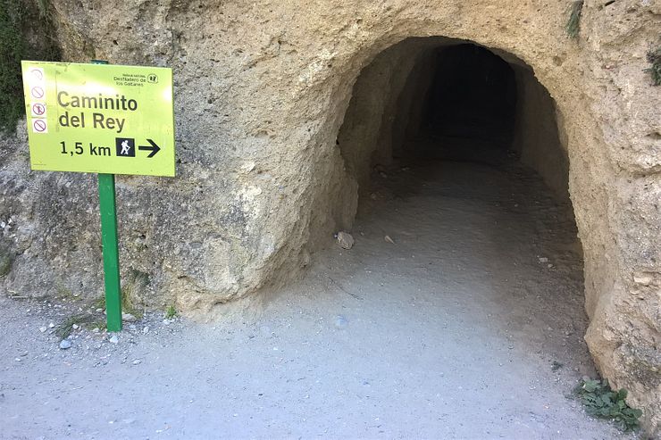
There are two access paths to the visitor reception center and you can take either of the two. One starts next to the El Kiosko restaurant, this is the one you see when you get off the shuttle bus. It starts with a passage through a short tunnel. Note that this path is the longer of the two, 2.7km so take the other one if you are arriving late.
The other path also starts with a passage through a tunnel, smaller but longer than the tunnel of the first path. This is a shortcut through the mountain and this path is only 1.5km. To reach the entrance to the tunnel, walk back on the road in the east/southeast direction (the shuttle bus came this way) a few hundred meters from the El Kiosko restaurant. See the map, it has a marker for the tunnel entrance. The tunnel is dark, but a cell phone is enough to use as a flashlight.
It doesn’t matter which path you take if you are not short on time. The spectacular views come later after passing the checkpoint.
The entire path from the start at El Kiosko restaurant to the train station and shuttle bus stop in El Chorro is 7.7km according to the official site. The interesting part between the two checkpoints is 2.9km starting at the visitor reception center next to the Gaitanejo Reservoir (don’t confuse it with the Guadalhorce reservoir). The first two sections of the boardwalk path pass through two canyons named Gaitanejo Gorge and Las Palomas Cliff.
A dirt path takes you through Hoyo Valley before the last and also best section of the boardwalk path starts. It passes through the third canyon, Gaitanes Gorge (Desfiladero de los Gaitanes). After exiting the canyon there is a stretch of boardwalk and road left to reach the second checkpoint where you return the hard hat and also the audio guide if you did the guided tour.
There is no need to know all this. After passing the first checkpoint there is only one way to go. Just walk the trail and enjoy the views!
The boardwalk starts after a short walk from the checkpoint. Gaitanejo Gorge, the first of the three canyons awaits. It required 19,939 wooden boards to build the whole boardwalk.
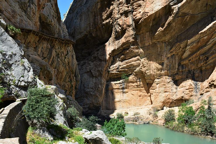
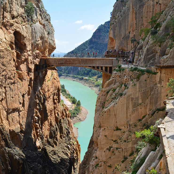
The narrowest canyon passage comes early on the path, the canyon is only about 10m wide here. It is an impressing view and a good start of the walk.
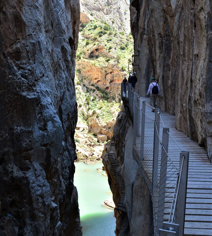 The narrowest canyon on the path.
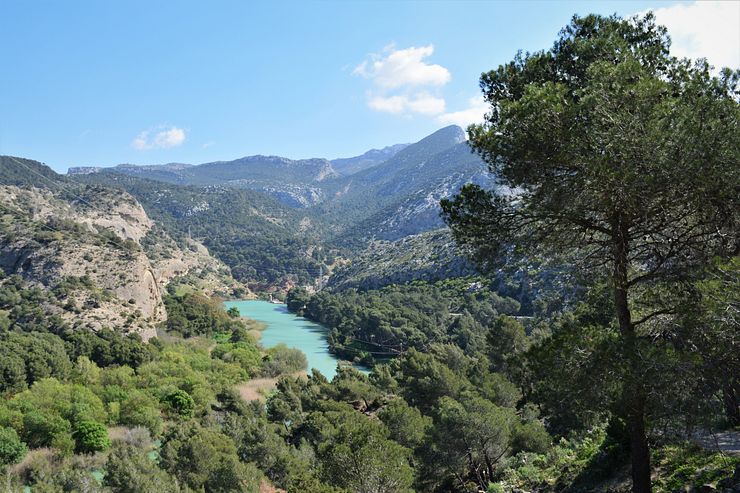
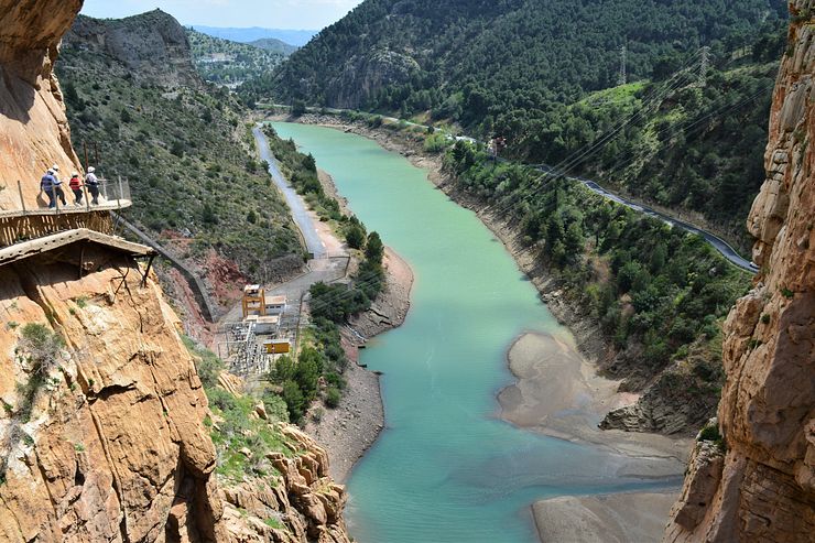
After passing through the narrow canyon, the path drops in elevation and runs close to the Guadalhorce river. This part is called the Soto. It has a small lagoon between the first and the second canyon.
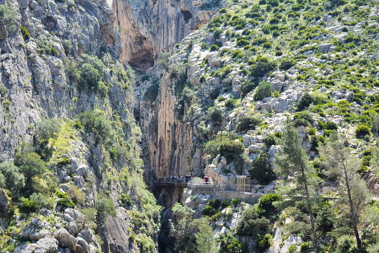
The path continues by making a long curve, leaving the Soto and entering the second canyon, Las Palomas Cliff. The boardwalk path is visible in the distance at the entrance to the canyon.
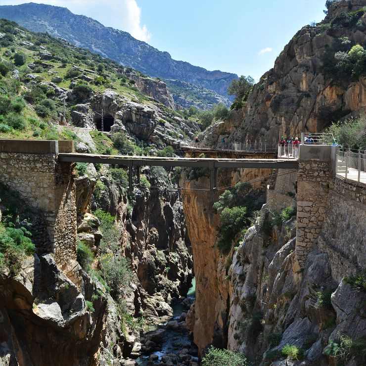
The path passes by The King’s Bridge (El Puente del Rey). The bridge got its name because King Alfonso XIII used it on his visit to El Caminito. It is forbidden to enter the bridge.
After exiting the canyon, the path continues through Hoyo Valley. The trail here is a dirt path and there is a rest area where you can take a break. This is around halfway through the walk and the best part is yet to come, the boardwalk through the third canyon, Desfiladero de los Gaitanes.
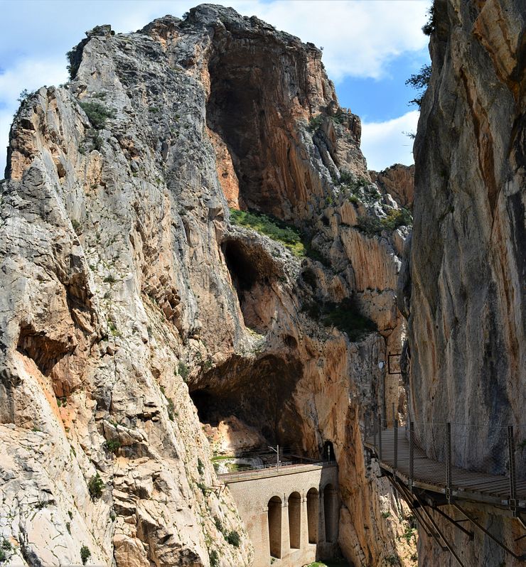
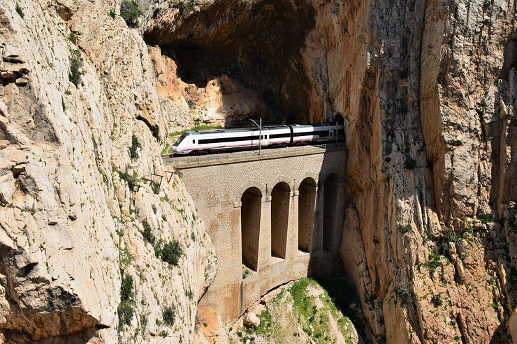
Access to the canyon is on the hanging boardwalk around 100m above the river. In some places you can see the old Caminito under the new boardwalk. After walking a while you reach a point where the railway passes through tunnels and over a viaduct in the cliff on the opposite side of the canyon.
The railway tunnels were made using dynamite and the line between Málaga and Córdoba required six years to complete.
Opposite the railway viaduct is a glass floor balcony (El Balcón de Cristal). This is one point on the path where you need to spend time in a queue if you wish to step out on the balcony. Only four persons are allowed to enter the balcony at the same time. You have almost the same view from the path next to the balcony so if you don’t want to wait in the line you can just pass it.
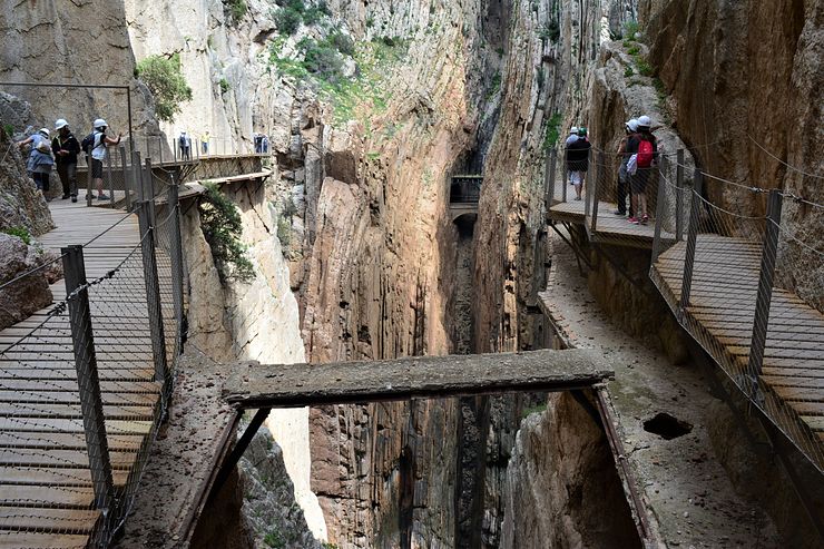
On this stretch, the new path is built just above the original path.
At the end of the canyon, the path crosses the gorge on a simple suspension bridge constructed for the new path. The old path crossed the canyon on top of the water aqueduct seen in front of the suspension bridge. In the lower right corner in the photo below, a part of the old path is visible.
It can be quite windy on the suspension bridge, but it feels safe to walk on. The view from the bridge towards El Chorro is nice.
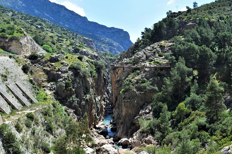
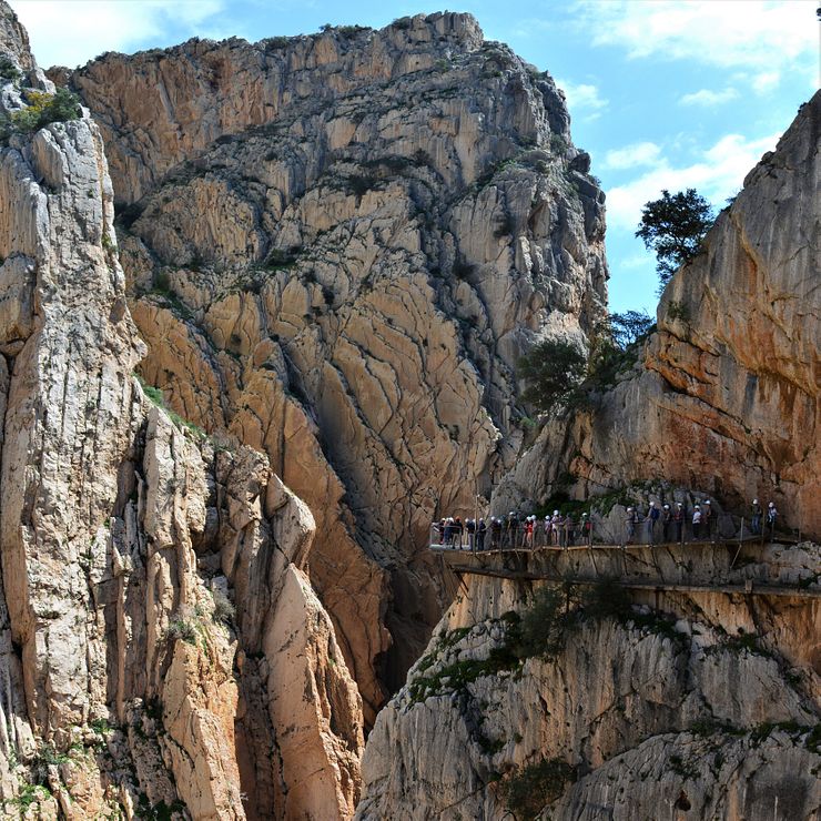
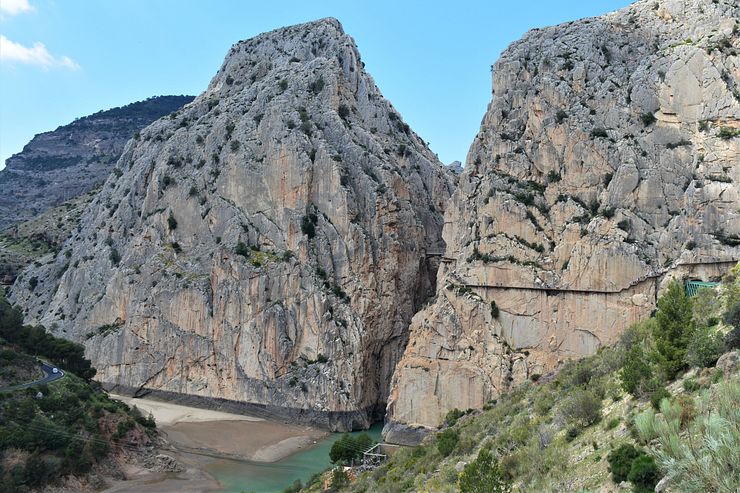
The boardwalk makes a left turn and exits Gaitanes Gorge. The last stretch of the path traverses the mountain wall and it looks quite spectacular from a distance. After exiting the boardwalk, you continue on a dirt road to the exit checkpoint and further on to the shuttle bus stop and train station in El Chorro.
Comments
Comments are closed. Contact me if you have a question concerning the content of this page.